 Walkably
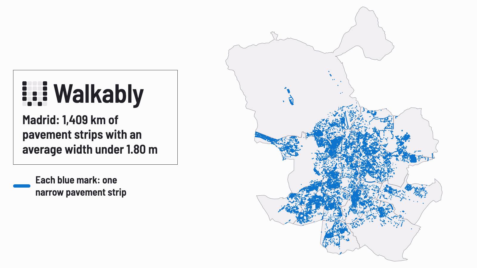
Madrid: 1,409 km of pavement strips with an average width under 1.80 m
About one kilometre in five of the pavement Madrid records is less than 1.80 m wide on average, by our count from the city's own data. That is the width Spain's accessibility rules ask for when a street is built or renewed.
Published
One example: 4.3 km of narrow pavement on a long avenue
On Avenida del Cardenal Herrera Oria in Fuencarral-El Pardo, about 4.3 km of the pavement strips along the avenue are under 1.80 m, by our match of the city's data to street names. An estimated 22,500 people live within 150 m of these narrow strips. We don't rank the streets: the way strips are matched to street names changes many streets' figures.
The rule covers new and renewed streets only
Spain's 2021 accessibility order for public space (Orden TMA/851/2021, article 5) asks for a walking route with a clear width of at least 1.80 m. It applies when a street is designed, built or renewed. Older pavements aren't bound by it. The city's figure is also not the same measure: it's the average width of the whole strip, not the free path. So these figures are not a count of pavements that fall short of the order.
We also counted the strips under 1.40 m: 603 km (8.6%). 1.40 m isn't a Spanish limit. It's the width French rules ask for on a walkway, and the line we used in the Paris story.
How we measured
The Ayuntamiento de Madrid publishes its pavement layer for anyone to reuse: 91,403 shapes, each with one average width. The city computes that width from each strip's area and perimeter, so it isn't a survey. We left out the 6,028 shapes under 0.5 m wide (174.6 km of kerb edges, parking bays and scraps that nobody walks on). A strip's length is the long side of a rectangle with the same area and outline. A street with a pavement on both sides counts twice. In all, 1,409 of the 7,017 km of strips we counted (20.1%) have a recorded average width under 1.80 m.
An average taken from the shape reads lower than the real width on short strips and corners. By our estimate, about 82 km of the 1,409 km (5.8%) come from this effect and not from a narrow pavement. The layer also holds squares, parks and rural roads. It doesn't show bins, café terraces, trees or lamp posts, which make the free path narrower.
The layer has no street names. We matched each strip to a street in the city's street layer; 98 km of the narrow strips have no street, so they're in the totals but not in our street list. A street's figure is therefore an estimate. The number of residents near a street is our estimate from a population grid, rounded to the nearest 500.
Origen de los datos: Ayuntamiento de Madrid. Fecha de creación del conjunto de datos: 1 de julio de 2026. The Ayuntamiento hasn't reviewed or endorsed this count.
Every Madrid neighbourhood's score for daily needs on foot is on the Madrid map.
We have the street list for all 21 districts. If you have questions or want the street list for your district, write to us through our press page.
Data and sources
Ayuntamiento de Madrid pavement, street and district layers, saved on 12 November 2026. How the score works.
Sources:
- Orden TMA/851/2021, article 5 (1.80 m clear width), Boletín Oficial del Estado (in Spanish)
- Arrêté du 15 janvier 2007, article 1 (1.40 m walkway, France), Légifrance (in French)
- Ayuntamiento de Madrid geoportal: average pavement width layer (in Spanish)
- Ayuntamiento de Madrid, general conditions for reusing its data (in Spanish)