 Walkably
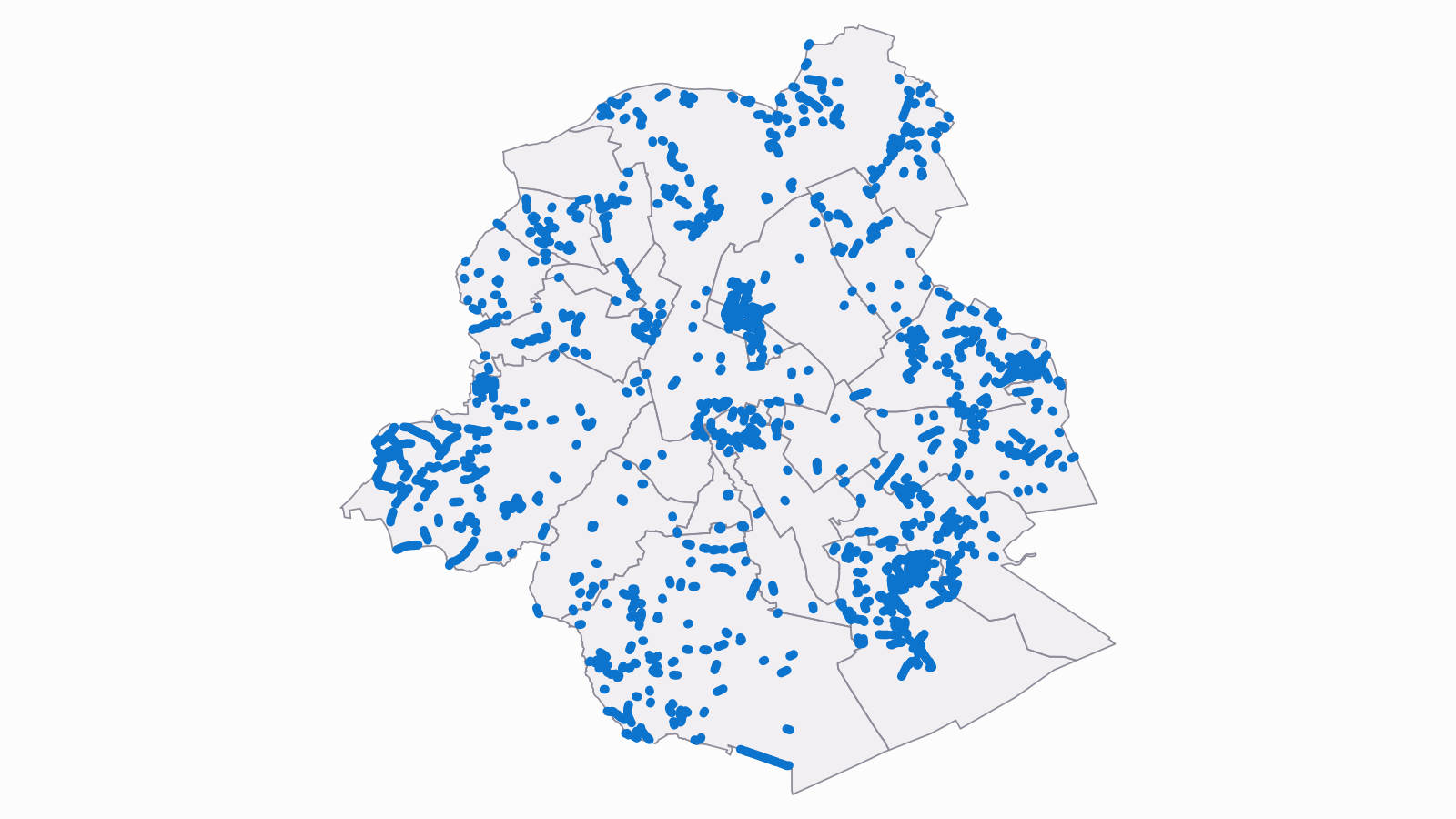
Brussels: 1,627 stretches of pavement are narrower than 1.50 m
On about 720 Brussels streets, the pavement is narrower than 1.50 m for 30 m or more: 1,627 stretches, 103.8 km of street side. On about 300 of these streets it is narrow on both sides. 1.50 m is the clear path the Region's planning rule asks for when a pavement is built or rebuilt.
Published
The streets where most people live
We ranked the list by how many people live within 150 m, because a narrow pavement affects more people where more people live. Rue Van Dyck in Schaerbeek comes first, with about 3,700 residents within 150 m. Then come Rue de la Colonne in Molenbeek, Rue de l'Enclume in Saint-Josse, Rue L'Olivier in Schaerbeek and Chaussée de Merchtem in Molenbeek, each with about 2,800 to 3,100. All of them except Rue de l'Enclume have a narrow stretch on both sides of the street.
Showing 10 of 1,627 stretches, most residents first. A street can have more than one stretch.
| Street | Commune | Length | Residents within 150 m |
|---|---|---|---|
| Rue Van Dyck - Van Dyckstraatsouth-west side | Schaerbeek | 213 m | 3,700 |
| Rue de la Colonne - Kolomstraatsouth-west side | Molenbeek-Saint-Jean | 101 m | 3,100 |
| Rue de l'Enclume - Aambeeldstraatwest side | Saint-Josse-ten-Noode | 49 m | 3,100 |
| Rue L'Olivier - L'Olivierstraatsouth side | Schaerbeek | 59 m | 3,000 |
| Chaussée de Merchtem - Steenweg op Merchtemwest side | Molenbeek-Saint-Jean | 41 m | 2,800 |
| Rue de la Colonne - Kolomstraatnorth-east side | Molenbeek-Saint-Jean | 61 m | 2,800 |
| Rue Van Male de Ghorain - Van Male de Ghorainstraatsouth-west side | Molenbeek-Saint-Jean | 42 m | 2,700 |
| Rue Van Male de Ghorain - Van Male de Ghorainstraatnorth-east side | Molenbeek-Saint-Jean | 42 m | 2,700 |
| Chaussée de Jette - Jetsesteenwegsouth-west side | Koekelberg | 71 m | 2,700 |
| Avenue du Condor - Condorlaannorth side | Molenbeek-Saint-Jean | 224 m | 2,700 |
What the rule says
The Brussels regional planning rule (RRU, Title VII, article 4, paragraph 1) asks for a clear path at least 1.50 m wide, free of obstacles, on every walking route. It applies when a pavement is built or rebuilt. It doesn't require the Region or the communes to widen every pavement that exists today.
How we measured
We cut each pavement on the Region's street map (UrbIS) into pieces about 10 m long and measured each piece from the kerb to the outer edge of the mapped pavement. A stretch counts when three pieces in a row, about 30 m of street, are narrower than 1.50 m. Corners and crossings are left out, and so are main roads, living streets, quays and streets without a name.
Benches, posts, bins and café terraces aren't taken away from the width, so the free path on these stretches is, if anything, narrower. Where a pavement borders a park, a garden or a field, its outer edge isn't a wall, and the pavement may be wider in use than on the map. This happens most in the outer communes, so we don't rank the communes.
The number of residents near each stretch is our estimate from the 2021 census population grid. For an area this small it can be off by a fair margin, so we round it to the hundred and use it only to order the list.
Every Brussels neighbourhood's score for daily needs on foot is on the Brussels map.
Questions, or the data in another format: write to us through our press page.
Data and sources
Brussels Region street map (UrbIS), pavement outlines read on 10 November 2026; street names from the map data. How the score works.
Sources: